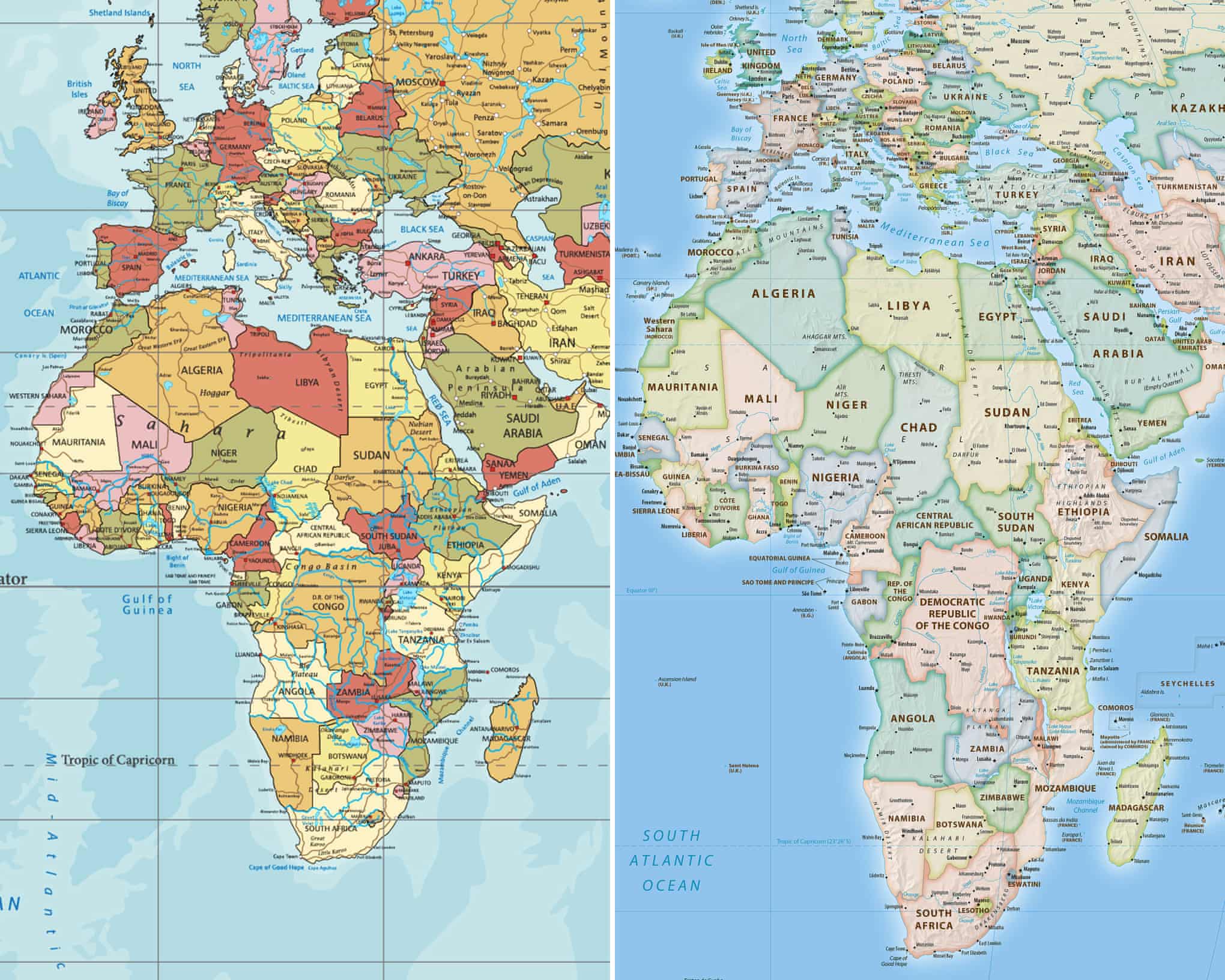
Key Takeaway: On September 4, 2026, the UN General Assembly passed a resolution, backed 164 to 1 with 6 abstentions, encouraging governments, schools, and institutions to replace the 16th century Mercator map with the Equal Earth projection, which shows Africa at its true size, nearly twice as large as Russia and roughly 14 times larger than Greenland. The resolution carries no binding force. What it does carry is a formal, near unanimous international acknowledgment that a map most of the world grew up trusting has been quietly misrepresenting a continent's scale for four and a half centuries.
Maps look like neutral facts. They are not. The Mercator projection, created in 1569 to help European sailors hold a straight compass bearing across open ocean, does that job well and one other job badly: it inflates the visual size of anything far from the equator and shrinks anything close to it. Africa sits on the equator. So on the map most classrooms, news broadcasts, and phone apps have used for generations, Africa looks roughly the same size as Greenland. It is actually about 14 times larger. That gap between a 16th century navigation tool and a 21st century mental model of the world is now, for the first time, the subject of a formal UN resolution.
What the Resolution Actually Says
The "Correct the Map" resolution, introduced by Togo on behalf of the African Union alongside the Bahamas, passed the General Assembly on September 4 with 164 votes in favor, six abstentions, and one vote against, cast by the United States. Its text encourages, rather than requires, UN member states, international organizations, schools, media, and technology companies to adopt the Equal Earth projection or other equal-area maps when relative size matters, and to teach the limitations of any flat representation of a round planet. It does not ban the Mercator projection, and Togo's Foreign Minister Robert Dussey was explicit on the floor that the goal was not to condemn Mercator's continued usefulness for navigation, but to stop treating it as the default lens for understanding the relative size of the world's regions. The resolution's language frames the correction as an act of "cognitive justice and memorial reparation," tying the map debate directly to a longer running set of African led conversations at the UN about colonial legacy and historical representation.
The Numbers Behind the Vote
Africa's land area is approximately 30.4 million square kilometers, nearly twice the size of Russia's 17.1 million square kilometers, despite Russia consistently appearing larger on Mercator based maps. The continent is larger than the United States, China, India, Japan, and most of Europe combined. The Equal Earth projection driving this resolution was developed in 2018 by cartographers Bojan Šavrič, Tom Patterson, and Bernhard Jenny specifically to preserve true relative area while remaining visually usable, unlike some older equal-area projections that distort shape too aggressively to be practical. The campaign behind the resolution, led by the advocacy groups Africa No Filter and Speak Up Africa and formally adopted by the African Union in March 2026, moved from AU endorsement to a UN vote in under six months, a fast track for a symbolic resolution at an institution not known for speed.
Where the Consensus Breaks Down
The near unanimous vote obscures a real fault line. The United States cast the sole vote against the resolution, with its delegation arguing that the General Assembly was spending its time on "map projections from the 16th century" instead of core issues of international peace, and describing the resolution as part of a "radical ideological project" that undermines the UN's credibility. That framing treats the vote as culture war symbolism rather than cartographic correction. On the other side, France's Foreign Minister Jean-Noël Barrot announced, hours before the vote, that France would independently drop Mercator from its own official world maps, aligning a major Western European government with the African led position and signaling that the debate has already outgrown the resolution itself. Worth noting too: the resolution is non-binding. It changes no law, mandates no textbook, and does not require Google, Apple, or any GIS vendor to update a single default setting. Its power, if it has any, is normative: it gives governments, publishers, and platforms cover and a citable precedent to make a change many had already been drifting toward since Google Maps introduced a 3D globe default in 2018.
What This Means for Decision-Makers
If you build, publish, or teach with maps, treat this resolution as a prompt to audit your defaults rather than a mandate to act on. Check what projection your dashboards, reports, textbooks, or platforms actually use, and whether that choice was ever a deliberate decision or simply an inherited default from a template built years ago. If your work touches Africa specifically, whether investment analysis, market sizing, or logistics planning, be aware that Mercator's distortion has likely shaped assumptions your audience holds before they see your data, and a true scale visual can do real persuasive work that a caption alone cannot. Do not expect fast downstream change: a non-binding UN resolution moves institutions on the timescale of years, not weeks, and the US's dissent signals this will remain politically contested rather than settled. Watch three concrete indicators over the next twelve months: whether major GIS and mapping platforms change default projections, whether textbook publishers in non-US markets update editions, and whether other UN bodies or regional blocs pass matching resolutions, since that would signal the shift from symbolic to structural.
—
Sources & Further Reading
- CNN, "UN votes to adopt new map that makes our world look very different" — https://www.cnn.com/2026/09/04/world/un-vote-new-world-map-intl-scli
- UN News, "UN tells the world: Stop making Africa look small" — https://news.un.org/en/story/2026/09/1168284
- The National, "US opposes UN adoption of map showing Africa's true size" — https://www.thenationalnews.com/news/us/2026/09/04/mercator-map-un-equal-earth-us/
- NPR, "The U.N. backs a new world map showing Africa in its true relative size" — https://www.npr.org/2026/09/04/nx-s1-5958611/africa-world-map-un-vote
Comments